
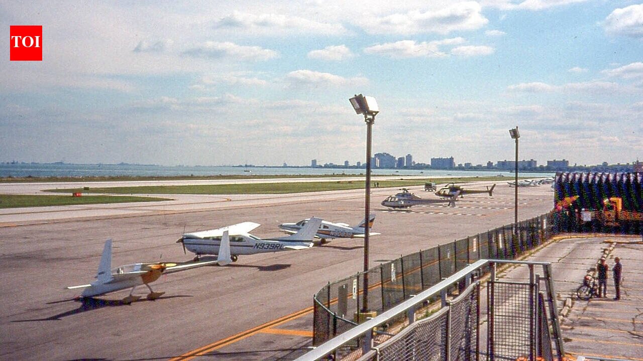
When Chicago residents woke up on March 31, 2003, one of the city’s most recognisable small airports had effectively disappeared overnight. Under orders from then-Mayor Richard M. Daley, construction crews arrived at Meigs Field in the early hours and carved six enormous X-shaped gouges into the runway, making it unusable. Sixteen aircraft were left stranded on the airfield. The Aircraft Owners and Pilots Association (AOPA), which reported on the closure as it unfolded, described how pilots initially faced uncertainty before arrangements were made for their departure. The dramatic closure ended Meigs Field’s role as Chicago’s lakefront airport. But the story of the site took another unexpected turn. Twelve years later, in 2015, 40 acres of the former airfield opened as a natural landscape of prairie, wetlands and wildlife habitat.
Six Xs in the runway
Meigs Field occupied Northerly Island, a narrow peninsula on Lake Michigan near downtown Chicago. It had served the city’s central business district for decades and remained an important airport for private and general aviation. However, its future had been debated for years. Daley had long supported replacing the airport with public parkland, while aviation groups and other supporters fought to keep it open. The dispute came to an abrupt end during the night of March 30 and the early morning of March 31, 2003. According to AOPA, city construction crews began tearing up the runway at around 1:30 a.m., with no advance warning to the Federal Aviation Administration (FAA). By morning, six giant X-shaped cuts had rendered the runway unusable and approximately 16 aircraft were stranded at the airport.The move immediately sparked controversy. Daley cited security concerns, arguing that an airport so close to Chicago’s skyscrapers posed a potential risk in the years following the September 11 attacks. Critics, however, saw the overnight operation as an extraordinary way to settle a long-running political battle over the future of the site.
What happened to the stranded planes?
The closure created an immediate problem for pilots whose aircraft were still parked at Meigs Field. With the runway destroyed, they could not simply take off.AOPA reported that city officials initially authorised the airport’s 3,100-foot taxiway to be used for southbound departures. However, with strong winds blowing from the north, the arrangement proved problematic. Later that day, northbound departures were also authorised, allowing pilots to begin leaving the field. The incident became one of the most unusual airport closures in modern American aviation history. The FAA later fined the City of Chicago $33,000 over the closure, and the image of the runway’s giant X-shaped gouges became a lasting symbol of the controversy surrounding Meigs Field’s final days.
From concrete to prairie
Once the airport was closed, work began on transforming Northerly Island. The U.S. Geological Survey (USGS) notes that the site hosted an airport from the 1920s through the 1990s and intermittently into the early 2000s. After the 2003 closure, the island began transitioning into parkland. The transformation was not simply about replacing a runway with grass. The southern section of Northerly Island was redesigned as an ecological landscape intended to bring natural habitats back to a highly urbanised section of Chicago’s lakefront.According to the U.S. Army Corps of Engineers, the broader 91-acre peninsula underwent ecological restoration, with approximately 40 acres on the southern side developed into restored coastal and wetland plant communities. The project was designed to support Great Lakes fish, amphibians, reptiles and migratory birds.In 2015, a 40-acre park opened on the southern part of the island. According to the U.S. Geological Survey, Northerly Island Park now covers 91 acres and includes the Northerly Island Natural Area, which supports migratory birds and wildlife, including monarch butterflies and herons.
A remarkable urban transformation
The contrast between Meigs Field’s final morning and what stands there today could hardly be greater. In 2003, the site was defined by a runway, parked aircraft and the controversy surrounding an overnight demolition. Twelve years later, part of that former airfield had become a landscape of prairie, wetlands and wildlife habitat. Aerial imagery preserved by the USGS also documents the changing face of Northerly Island and Chicago’s lakefront over the decades.Meigs Field’s closure remains controversial, particularly among aviation enthusiasts who saw the airport as an important part of Chicago’s transportation network. Yet its transformation also created something increasingly rare in a major American city: a sizeable natural refuge surrounded by one of the country’s most densely developed urban landscapes. Today, Northerly Island tells two very different stories at once, one about the dramatic end of an airport, and another about how a runway was eventually replaced by prairie, wetlands and wildlife.






Leave a Reply